
Trail System
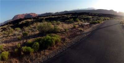
A unique way you can see the beauty of St. George is to travel its trail system that includes mostly paved surfaces. The City of St. George has developed approximately 25 miles of public trails and paths that traverse the city - with plans to add more in the near future.
While you avoid the traffic and stoplights on the road, you can also see and inspect the natural flora and fauna of the area. There are also many services along most of the paths including restrooms, drinking water, shelters, picnic areas, information kiosks and even access to some city parks. (Click here to see map of trail system)
Proper etiquette is greatly appreciated when using the trails. Pedestrians have the ultimate right-of-way, but they are encouraged to readily yield to cyclists and skaters. Travelers should stay to the right and pass on the left while audibly alerting others when passing. Some trails have marked path lines that facilitate the flow of traffic.
Bluff Street Trail:
This paved trail is about .8 miles long and begins at the intersection of Diagonal Street and follows Bluff Street north until Turtle Road. The Snow Canyon Trail and the State trail along SR-18 to the northwest entrance of Snow Canyon State Park are accessible from the Bluff Street Trail. This trail is handicap accessible.
Fort Pearce Trail:
Covering about .75 miles, this paved trail connects the end of St. James Lane and Larkspur Park at Ft. Pearce North. A highlight of this trail is a pedestrian bridge that spans the Ft. Pearce Wash, and it also showcases Southern Utah flora and fauna. It is handicap accessible and provides access to Larkspur Park.
Ft. Pierce Industrial Park Trail:
This paved trail spans about .6 miles in the industrial park near Bloomington Hills, and desert flora also accents the trail. It is handicap accessible.
Gas Line Trail:
This natural surface trail (soil and rock) connects the Ft. Pierce Industrial Park Trail and Desert Hills Intermediate School with a length of about 1.1 miles. There are scenic views of the desert landscape on this trail.
Halfway Wash Trail:
This paved trail connects 540 North with Snow Canyon Parkway while spanning a distance of about 1.6 miles. Halfway Wash, just south of Sunset Drive, has many beautiful cottonwood and willow trees. The trail provides access to Royal Oaks Park and is handicap accessible.
Hilton Drive Trail:
This paved trail parallels Hilton Drive and Interstate 15 for about 1.5 miles and runs between and connects with Virgin River Trail and J.C. Snow Park while going near the Dixie Center at the Confluence Trailhead. The trail is handicap accessible.
Sand Hollow Wash Trail:
This 1.8 mile paved trail connects the Sand Hollow Aquatic Center and the Canyons Complex. It is handicap accessible.
Snow Canyon Trail:
This 3.1 mile paved trail connects the intersection of SR-18 and where Snow Canyon Parkway crosses over the Ivins city limits as it follows the parkway on its north side. As it go through this area there are scenic views of desert fauna from the trail. It connects with the State trail on SR-18, Halfway Wash Trail, and Bluff Street Trail. The trail is handicap accessible.
Temple Quarry Trail:
Spanning about 2.1 miles, this natural surface trail provides scenic views of St. George and Green Valley. It is accessible from Donlee Drive just northeast of the airport.
Virgin River Trail:
This paved trail covers about 8.2 miles along the north bank of the Virgin River while providing scenic views of the river and its surrounding flora and fauna. It can be accessed by the Man of War, Confluence, and Riverside trailheads and is handicap accessible.
Virgin River South Trail:
This 1.2 mile paved trail runs along the south bank of the Virgin River and connects the Virgin River Trail and Ft. Pearce Trail. The flora and fauna of the Virgin River flood plain make this a beautiful trail. The trail is handicap accessible.
Webb Hill Trail:
This .75 mile long paved trail has scenic views of St. George and the Virgin River as it connects Vermillion Avenue in Bloomington Hills and 60 East. It is handicap accessible.
Park Trails:
There are paved trails in Mathis, Tonaquint, Centennial, Larkspur, and Bloomington Hills North parks. These trails will soon connect to the city’s trail system, if they do not all ready do so.
 Middleton Wash Trail:
This trail will be a 1.5 mile long trail. It will follow the Middleton Wash from Red Cliffs Mall to the banks of the Virgin River and will eventually connect with the Virgin River Trail so that Bloomington and Washington City are connected by the trail system.
Santa Clara River Trail:
This trail will span 3.2 miles and will connect Tonquint Park and Mathis Park while paralleling the Santa Clara River.
Did you like this page? Did you find it helpful? Please consider sharing.